Triangulation Pillars or Trig Pillars are concrete pillars, 4 feet high and 2 feet square at the base positioned on high points throughout the country that were used by the Ordnance Survey for mapping. Several others can be seen from each pillar so that their position could be triangulated using a theodolite that was fixed to a metal plate on the top. The ones listed here were all built around 1959 but there are a previous generation of pillars that were built when Ireland was mapped for the first time between 1824 and 1842 but very little if anything at all remains of them. There are 6 trig pillars in the Sliabh Aughty Mountains (debatable, it depends on how you define the region). This post is a WIP and I plan to get pictures of all listed below.
Cashlaundrumlahan
Coordinates: 53.09504, -8.61238
Irish Grid Reference: M5903005088
Height: 338.4m
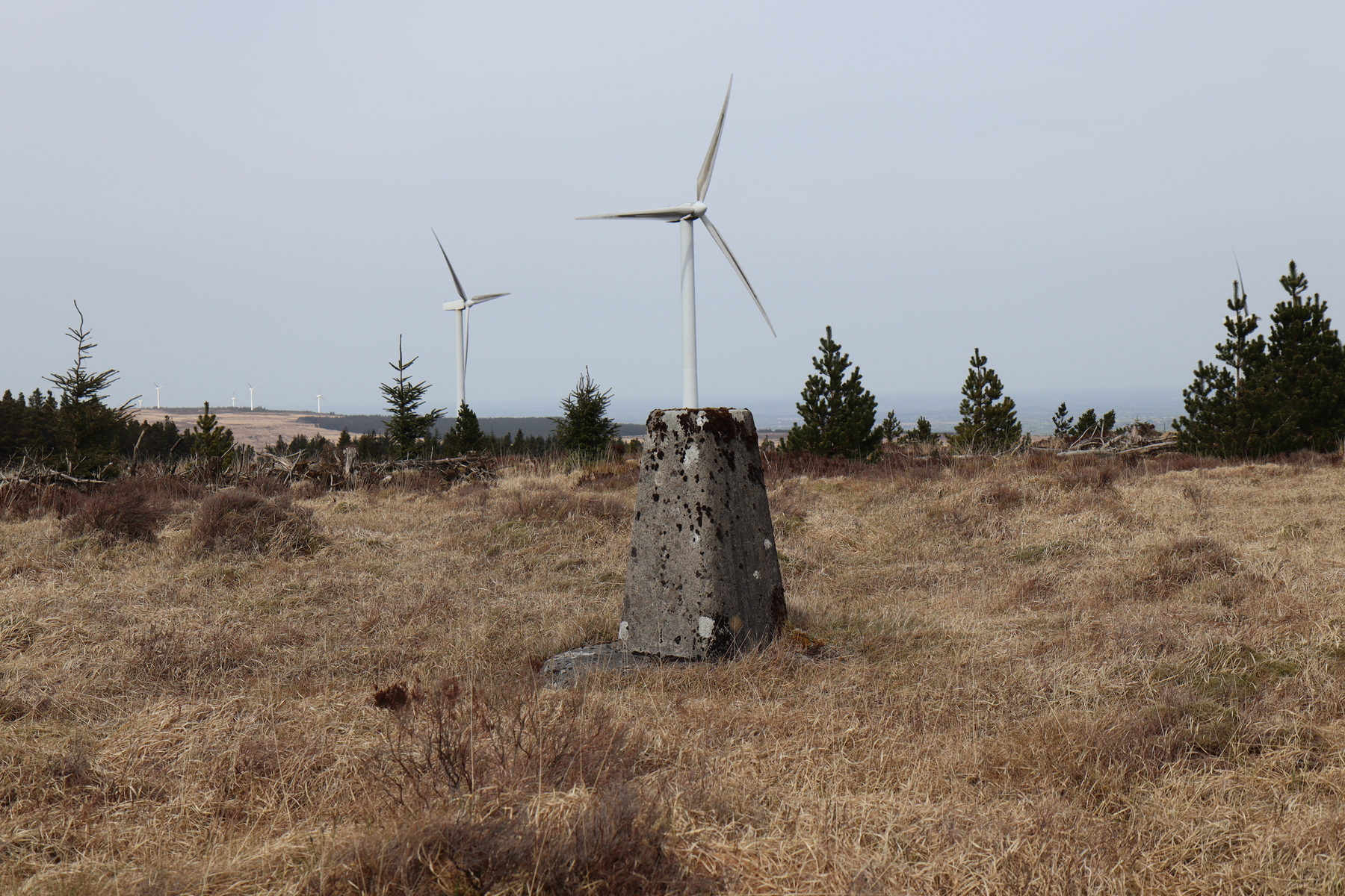


Terry Hill / Knockdrummore
Coordinates: 53.08398, -8.46064
Irish Grid Reference: M692037
Height: 181m


Cloghaun
Coordinates: 53.13067, -8.67144
Irish Grid Reference: M551090
Height: 289m


Cappaghabaun
Coordinates: 52.98002, -8.48041
Irish Grid Reference: R677922
Height: 378m


Maghera
Coordinates: 52.96785, -8.7182
Irish Grid Reference: R518910
Height: 400m
Caher
Coordinates: 52.93944, -8.80401
Irish Grid Reference: R460879
Height: 250m
Other Possible Inclusions
These are trig pillars that may not be strictly in the Sliabh Aughty region but are worthy of mention.
Bunduff
Coordinates: 53.10013, -8.8294
Irish Grid Reference: M445058
Height: 123m
This is recorded by Trigpointing Ireland but I’m not sure if it exists. The grid reference given puts it right in the middle of the new M18 motorway just outside Gort. It’s possible it could have been destroyed during the construction of the motorway.
Derryfrench
Coordinates: 53.15996, -8.38142
Irish Grid Reference: M743125
Height: 103m
Church Hill
Coordinates: 53.11679, -8.27205
Irish Grid Reference: M818073
Height: 91m
Monreagh
Coordinates: 52.97555, -8.89665
Irish Grid Reference: R398919
Height: 66m
Knockdoon
Coordinates: 52.8587, -8.74553
Irish Grid Reference: R497788
Height: 93m
Map
Links
Trig Pointing Ireland - About Trig Pointing Ireland - Gridref Trig Pillars ,Triangulation and the Mapping of Ireland